Polar lows are the part of a larger class of mesoscale weather systems. They are short but extremely intense weather phenomena which are observed over the cold waters of the ocean, have a characteristic scale of up to 1000 km and is characterized by strong rainfall and wind speeds exceeding 12 m/s.
There are two visualization modes: the first is the static data represented by each cyclone and the second mode is the motion-animated cyclones.
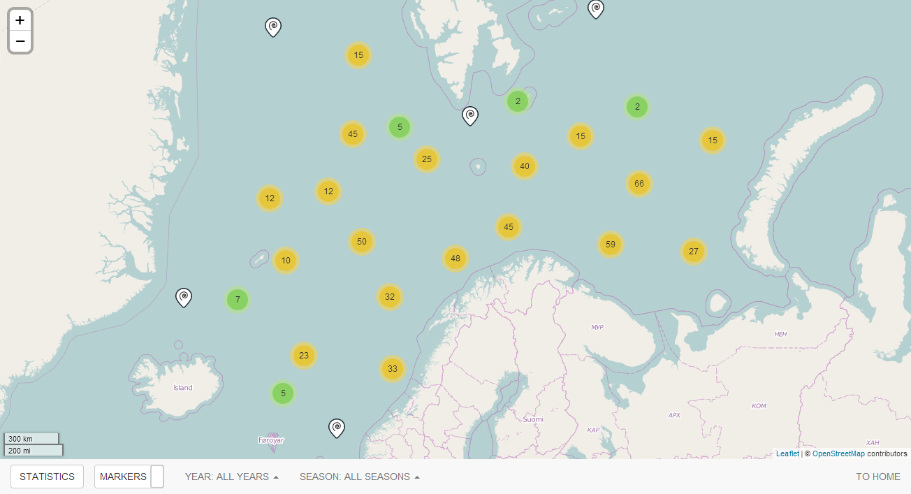
Powerful storm polar lows having wind speeds of about 25 m/c are known to be the cause of hazardous weather. Polar lows present themselves as the atmospheric phenomena the horizontal dimensions of which do not exceed 1,000 km, appear and which exist from 12 to 24 hours. The wave fall and low temperatures can lead to increased probability of vessel icing the intensity of which increases with the high wind speed and large wave height. Study of the mesoscale processes, such as polar lows in the Arctic has become especially relevant due to the sharp sea ice decreasing in the Arctic Ocean and Arctic seas in recent years. Only the use of satellite data allows obtaining regular and spacious information about the polar lows. Early detection and evaluation of the characteristics of the polar lows is an extremely important task to ensure the safety of navigation, fishing and oil industry in the Arctic region. With new open areas dangerous polar lows can arise over them.
The present-day meteorological observational network has severe limitations in detecting all, especially small mesoscale cyclones, so there is a strong need for new and/or improved methods to detect and monitor polar lows. Satellite remote sensing seems to be the most feasible tool for early detection and monitoring of the polar lows. Several remote sensing sensors are capable to detect a polar low but each of them suffers from various deficiencies. In the work, satellite passive microwave data have been intensively exploited aiming at obtaining the fields of geophysical parameters inside the polar lows. DMSP Special Sensor Microwave/Imager – SSM/I data were used in the research. Quantitative fields of geophysical parameters such as total atmospheric water vapour content, total cloud liquid water content inside the polar lows were built using SSM/I data has estimated. The polar lows have been identified on satellite passive microwave imagery by fields of means of analysis of atmospheric water vapour and cloud liquid water fields. High accuracy Neural Network-based algorithms for atmospheric total water vapour content and total cloud liquid water content retrievals from SSM/I data over the open polar oceans have been developed tuned and validated (Bobylev L., Zabolotskikh E. et al., 2010). These algorithms were used for parameters estimation inside the polar lows over the Nordic seas. Such parameter as total atmospheric water vapour content inside polar lows was estimated for the period of 1995 – 2008 over the Nordic seas. The polar lows were identified in atmospheric water vapour fields by means of visual analysis.
Therefore the study of polar low characteristics, their timely detection, tracking their movement and forecasting still represent a challenge for the modern science.